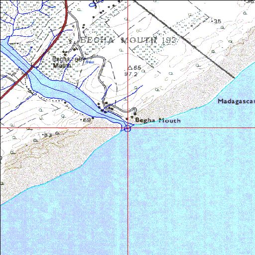
Condition: Excellent
Northern bank artificially stabilized near the mouth
33o22'57.2"S 27o19'34.5"E
(-33.382558, 27.326247)
Map 3327AD
3814m wide x 4567m high
Cape Datum.
Surveys and Mapping.
Data from file
/iwqs3/tmp/riv/wes_akw-geo
| Bira Temporarily open/closed estuary. | ||
|---|---|---|
|
|
|
|
|
Information: Poor Condition: Excellent Northern bank artificially stabilized near the mouth |
||
|
Locality: 33o22'57.2"S 27o19'34.5"E (-33.382558, 27.326247) Map 3327AD 3814m wide x 4567m high Cape Datum. |
||
|
Surveys and Mapping. Data from file /iwqs3/tmp/riv/wes_akw-geo |
||
| <--Previous | Home^ | Next--> | |
| SA Inst. for Aquatic Biodiversity | stmaphtml.aml 2003-09-04 - 14:40:48 | |