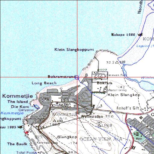
Condition: Poor
Stormwater input from township development
34o08'00.9"S 18o20'02"E
(-34.133597, 18.33389)
Map 3418AB
3780m wide x 4567m high
Cape Datum.
Surveys and Mapping.
Data from file
/iwqs3/tmp/riv/wes_akw-geo
| Bokramspruit Temporarily open/closed estuary. | ||
|---|---|---|
|
|
|
|
|
Information: Poor Condition: Poor Stormwater input from township development |
||
|
Locality: 34o08'00.9"S 18o20'02"E (-34.133597, 18.33389) Map 3418AB 3780m wide x 4567m high Cape Datum. |
||
|
Surveys and Mapping. Data from file /iwqs3/tmp/riv/wes_akw-geo |
||
| <--Previous | Home^ | Next--> | |
| SA Inst. for Aquatic Biodiversity | stmaphtml.aml 2003-09-04 - 13:30:42 | |