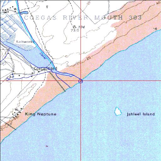
Condition: Poor
Estuary has been converted into a salt works
33o47'49.9"S 25o41'43.5"E
(-33.797193, 25.695406)
Map 3325DC
3795m wide x 4567m high
Cape Datum.
Surveys and Mapping.
Data from file
/iwqs3/tmp/riv/wes_akw-geo
| Coega (Ngcura) Temporarily open/closed estuary. | ||
|---|---|---|
|
|
|
|
|
Information: Poor Condition: Poor Estuary has been converted into a salt works |
||
|
Locality: 33o47'49.9"S 25o41'43.5"E (-33.797193, 25.695406) Map 3325DC 3795m wide x 4567m high Cape Datum. |
||
|
Surveys and Mapping. Data from file /iwqs3/tmp/riv/wes_akw-geo |
||
| <--Previous | Home^ | Next--> | |
| SA Inst. for Aquatic Biodiversity | stmaphtml.aml 2003-09-04 - 14:27:31 | |