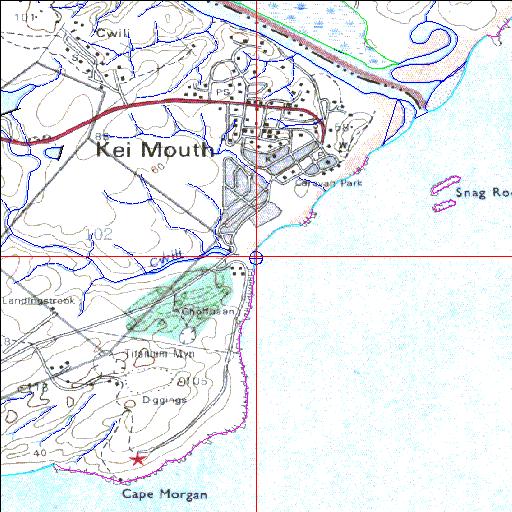
Cwili Temporarily open/closed estuary.
Cwili Temporarily open/closed estuary. Cwili position
Information: Poor
Condition: Good

Catchment in excellent condition but remnants of old road bridge in estuary
Locality:
32o41'27.1"S 28o22'29.3"E
(-32.690861, 28.374794)
Map 3228CB
3844m wide x 4567m high
Cape Datum.
South Africa DLA, DWAF 1:50 000 maps from
Surveys and Mapping.
Data from file
/iwqs3/tmp/riv/wes_akw-geo
<--Previous | Home^ Next-->
SA Inst. for Aquatic Biodiversity stmaphtml.aml 2003-09-04 - 15:07:20