Condition: Excellent
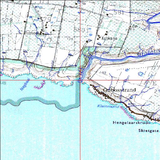
Eastern boundary of the Tsitsikamma National Park
34o03'34.5"S 24o11'42.1"E
(-34.059573, 24.195026)
Map 3424AA
3784m wide x 4567m high
Cape Datum.
Surveys and Mapping.
Data from file
/iwqs3/tmp/riv/wes_akw-geo
| Groot-East (Groot-Oos) River mouth. | ||
|---|---|---|
|
|
|
|
|
Information: Poor Condition: Excellent Eastern boundary of the Tsitsikamma National Park |
||
|
Locality: 34o03'34.5"S 24o11'42.1"E (-34.059573, 24.195026) Map 3424AA 3784m wide x 4567m high Cape Datum. |
||
|
Surveys and Mapping. Data from file /iwqs3/tmp/riv/wes_akw-geo |
||
| <--Previous | Home^ | Next--> | |
| SA Inst. for Aquatic Biodiversity | stmaphtml.aml 2003-09-04 - 14:14:21 | |