Haga-Haga Temporarily open/closed estuary.
Haga-Haga Temporarily open/closed estuary. Haga-Haga position
Information: Poor
Condition: Excellent

Increased pressure on freshwater supply for resort development
Locality:
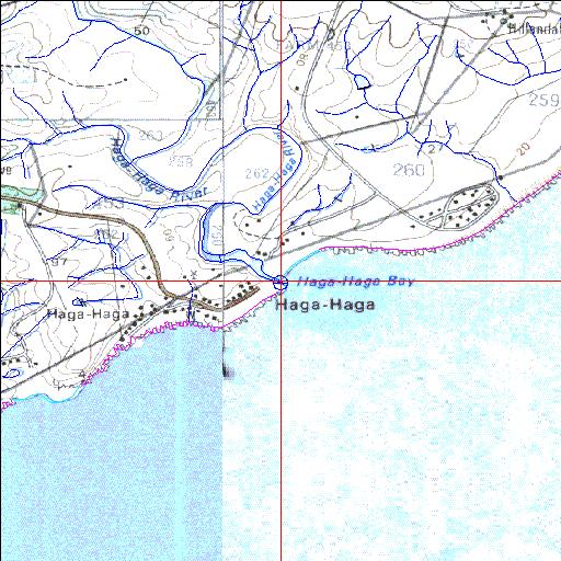
32o45'42.5"S 28o15'15.8"E
(-32.761803, 28.254382)
Map 3228CA 3228CB 3228CC
3841m wide x 4567m high
Cape Datum.
South Africa DLA, DWAF 1:50 000 maps from
Surveys and Mapping.
Data from file
/iwqs3/tmp/riv/wes_akw-geo
<--Previous | Home^ Next-->
SA Inst. for Aquatic Biodiversity stmaphtml.aml 2003-09-04 - 15:03:37