Condition: Good
Farmlands in catchment may impact on estuary
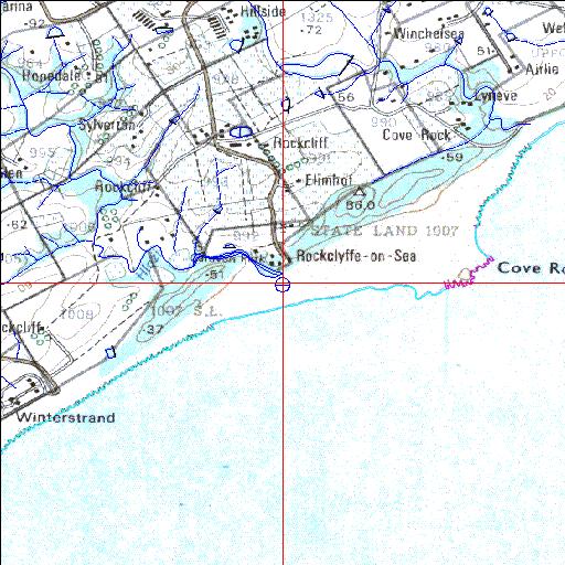
33o05'09.8"S 27o48'39.4"E
(-33.086049, 27.810943)
Map 3327BB
3826m wide x 4567m high
Cape Datum.
Surveys and Mapping.
Data from file
/iwqs3/tmp/riv/wes_akw-geo
| Hlozi Temporarily open/closed estuary. | ||
|---|---|---|
|
|
|
|
|
Information: Poor Condition: Good Farmlands in catchment may impact on estuary |
||
|
Locality: 33o05'09.8"S 27o48'39.4"E (-33.086049, 27.810943) Map 3327BB 3826m wide x 4567m high Cape Datum. |
||
|
Surveys and Mapping. Data from file /iwqs3/tmp/riv/wes_akw-geo |
||
| <--Previous | Home^ | Next--> | |
| SA Inst. for Aquatic Biodiversity | stmaphtml.aml 2003-09-04 - 14:50:19 | |