Kabeljous Temporarily open/closed estuary.
Kabeljous Temporarily open/closed estuary. Kabeljous position
Information: Moderate
Condition: Good

Threatened with increased freshwater demand for catchment irrigation
Locality:
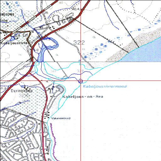
34o00'17.4"S 24o56'13.5"E
(-34.004826, 24.937086)
Map 3324DD 3424BB
3786m wide x 4567m high
Cape Datum.
South Africa DLA, DWAF 1:50 000 maps from
Surveys and Mapping.
Data from file
/iwqs3/tmp/riv/wes_akw-geo
<--Previous | Home^ Next-->
SA Inst. for Aquatic Biodiversity stmaphtml.aml 2003-09-04 - 14:20:33