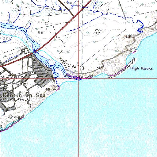
Condition: Fair
Reduced freshwater input due to urban and agricultural demands
33o40'55.9"S 26o41'15.6"E
(-33.682201, 26.687672)
Map 3326DA
3800m wide x 4567m high
Cape Datum.
Surveys and Mapping.
Data from file
/iwqs3/tmp/riv/wes_akw-geo
| Kariega Permanently open estuary. | ||
|---|---|---|
|
|
|
|
|
Information: Good Condition: Fair Reduced freshwater input due to urban and agricultural demands |
||
|
Locality: 33o40'55.9"S 26o41'15.6"E (-33.682201, 26.687672) Map 3326DA 3800m wide x 4567m high Cape Datum. |
||
|
Surveys and Mapping. Data from file /iwqs3/tmp/riv/wes_akw-geo |
||
| <--Previous | Home^ | Next--> | |
| SA Inst. for Aquatic Biodiversity | stmaphtml.aml 2003-09-04 - 14:31:00 | |