Condition: Excellent
State owned property
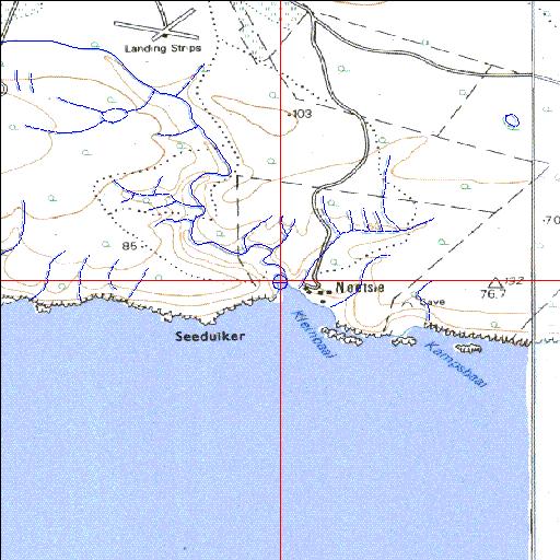
34o27'05.6"S 20o43'53.5"E
(-34.451559, 20.731518)
Map 3420BC 3420BD
3766m wide x 4567m high
Cape Datum.
Surveys and Mapping.
Data from file
/iwqs3/tmp/riv/wes_akw-geo
| Klipdrifsfontein Temporarily open/closed estuary. | ||
|---|---|---|
|
|
|
|
|
Information: Poor Condition: Excellent State owned property |
||
|
Locality: 34o27'05.6"S 20o43'53.5"E (-34.451559, 20.731518) Map 3420BC 3420BD 3766m wide x 4567m high Cape Datum. |
||
|
Surveys and Mapping. Data from file /iwqs3/tmp/riv/wes_akw-geo |
||
| <--Previous | Home^ | Next--> | |
| SA Inst. for Aquatic Biodiversity | stmaphtml.aml 2003-09-04 - 13:46:28 | |