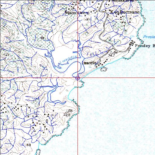
Condition: Excellent?
Baseline studies urgently required
31o53'25.2"S 29o14'48.8"E
(-31.890322, 29.246891)
Map 3129CC
3878m wide x 4567m high
Cape Datum.
Surveys and Mapping.
Data from file
/iwqs3/tmp/riv/wes_akw-geo
| Lwandile Temporarily open/closed estuary. | ||
|---|---|---|
|
|
|
|
|
Information: Poor Condition: Excellent? Baseline studies urgently required |
||
|
Locality: 31o53'25.2"S 29o14'48.8"E (-31.890322, 29.246891) Map 3129CC 3878m wide x 4567m high Cape Datum. |
||
|
Surveys and Mapping. Data from file /iwqs3/tmp/riv/wes_akw-geo |
||
| <--Previous | Home^ | Next--> | |
| SA Inst. for Aquatic Biodiversity | stmaphtml.aml 2003-09-04 - 15:35:06 | |