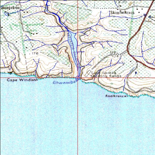
Condition: Good
Dense stands of exotic vegetation in the catchment
34o03'15"S 22o21'18.7"E
(-34.054157, 22.355201)
Map 3422AB
3784m wide x 4567m high
Cape Datum.
Surveys and Mapping.
Data from file
/iwqs3/tmp/riv/wes_akw-geo
| Maalgate Temporarily open/closed estuary. | ||
|---|---|---|
|
|
|
|
|
Information: Poor Condition: Good Dense stands of exotic vegetation in the catchment |
||
|
Locality: 34o03'15"S 22o21'18.7"E (-34.054157, 22.355201) Map 3422AB 3784m wide x 4567m high Cape Datum. |
||
|
Surveys and Mapping. Data from file /iwqs3/tmp/riv/wes_akw-geo |
||
| <--Previous | Home^ | Next--> | |
| SA Inst. for Aquatic Biodiversity | stmaphtml.aml 2003-09-04 - 13:54:44 | |