Condition: Good
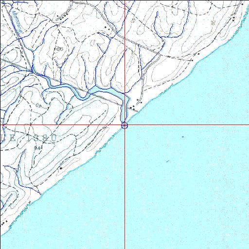
A good example of a well preserved system on the KwaZulu-Natal north coast
29o21'07.4"S 31o22'26.8"E
(-29.352066, 31.37411)
Map 2931AD
3981m wide x 4567m high
Cape Datum.
Surveys and Mapping.
Data from file
/iwqs3/tmp/riv/wes_akw-geo
| Mdlotane Temporarily open/closed estuary. | ||
|---|---|---|
|
|
|
|
|
Information: Poor Condition: Good A good example of a well preserved system on the KwaZulu-Natal north coast |
||
|
Locality: 29o21'07.4"S 31o22'26.8"E (-29.352066, 31.37411) Map 2931AD 3981m wide x 4567m high Cape Datum. |
||
|
Surveys and Mapping. Data from file /iwqs3/tmp/riv/wes_akw-geo |
||
| <--Previous | Home^ | Next--> | |
| SA Inst. for Aquatic Biodiversity | stmaphtml.aml 2003-09-04 - 16:46:49 | |