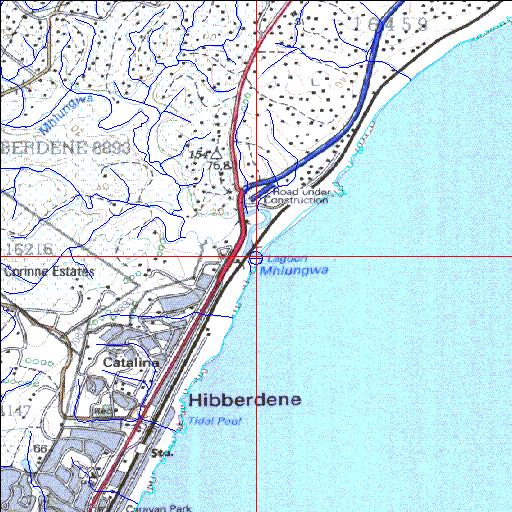
Condition: Poor
Siltation problems
30o33'35.4"S 30o35'02.7"E
(-30.559832, 30.584084)
Map 3030DA
3933m wide x 4567m high
Cape Datum.
Surveys and Mapping.
Data from file
/iwqs3/tmp/riv/wes_akw-geo
| Mhlungwa Temporarily open/closed estuary. | ||
|---|---|---|
|
|
|
|
|
Information: Moderate Condition: Poor Siltation problems |
||
|
Locality: 30o33'35.4"S 30o35'02.7"E (-30.559832, 30.584084) Map 3030DA 3933m wide x 4567m high Cape Datum. |
||
|
Surveys and Mapping. Data from file /iwqs3/tmp/riv/wes_akw-geo |
||
| <--Previous | Home^ | Next--> | |
| SA Inst. for Aquatic Biodiversity | stmaphtml.aml 2003-09-04 - 16:22:50 | |