Condition: Excellent
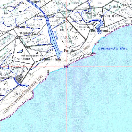
Causeway/weir at head of estuary
33o10'12.5"S 27o40'11.9"E
(-33.170137, 27.669965)
Map 3327BA
3823m wide x 4567m high
Cape Datum.
Surveys and Mapping.
Data from file
/iwqs3/tmp/riv/wes_akw-geo
| Ncera Temporarily open/closed estuary. | ||
|---|---|---|
|
|
|
|
|
Information: Poor Condition: Excellent Causeway/weir at head of estuary |
||
|
Locality: 33o10'12.5"S 27o40'11.9"E (-33.170137, 27.669965) Map 3327BA 3823m wide x 4567m high Cape Datum. |
||
|
Surveys and Mapping. Data from file /iwqs3/tmp/riv/wes_akw-geo |
||
| <--Previous | Home^ | Next--> | |
| SA Inst. for Aquatic Biodiversity | stmaphtml.aml 2003-09-04 - 14:47:42 | |