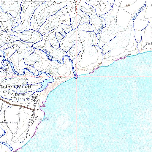
Condition: Excellent
This system appears to be in a near natural state
32o37'43.2"S 28o26'19.7"E
(-32.62866, 28.438799)
Map 3228CB
3846m wide x 4567m high
Cape Datum.
Surveys and Mapping.
Data from file
/iwqs3/tmp/riv/wes_akw-geo
| Ncizele Temporarily open/closed estuary. | ||
|---|---|---|
|
|
|
|
|
Information: Poor Condition: Excellent This system appears to be in a near natural state |
||
|
Locality: 32o37'43.2"S 28o26'19.7"E (-32.62866, 28.438799) Map 3228CB 3846m wide x 4567m high Cape Datum. |
||
|
Surveys and Mapping. Data from file /iwqs3/tmp/riv/wes_akw-geo |
||
| <--Previous | Home^ | Next--> | |
| SA Inst. for Aquatic Biodiversity | stmaphtml.aml 2003-09-04 - 15:11:20 | |