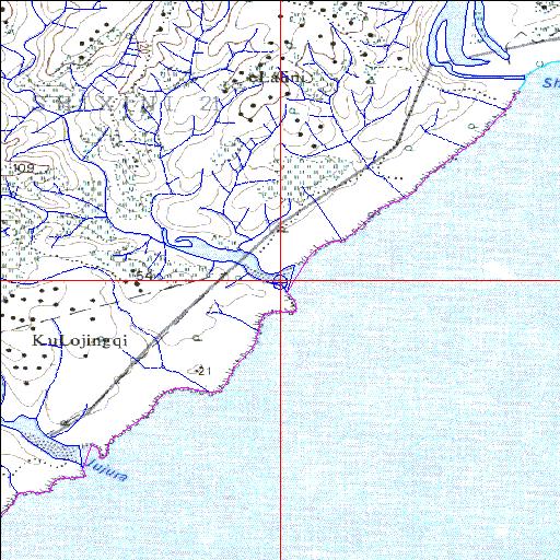
Condition: Good
Poor water quality requires attention
32o25'03.2"S 28o42'33.2"E
(-32.417559, 28.709225)
Map 3228BC
3855m wide x 4567m high
Cape Datum.
Surveys and Mapping.
Data from file
/iwqs3/tmp/riv/wes_akw-geo
| Ngadla Temporarily open/closed estuary. | ||
|---|---|---|
|
|
|
|
|
Information: Poor Condition: Good Poor water quality requires attention |
||
|
Locality: 32o25'03.2"S 28o42'33.2"E (-32.417559, 28.709225) Map 3228BC 3855m wide x 4567m high Cape Datum. |
||
|
Surveys and Mapping. Data from file /iwqs3/tmp/riv/wes_akw-geo |
||
| <--Previous | Home^ | Next--> | |
| SA Inst. for Aquatic Biodiversity | stmaphtml.aml 2003-09-04 - 15:19:09 | |