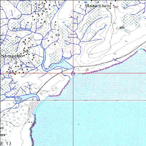
Condition: Excellent
Floodplain and surrounding area used for grazing cattle
32o29'32.5"S 28o36'51.5"E
(-32.492353, 28.614294)
Map 3228BC 3228DA
3852m wide x 4567m high
Cape Datum.
Surveys and Mapping.
Data from file
/iwqs3/tmp/riv/wes_akw-geo
| Ngqwara Temporarily open/closed estuary. | ||
|---|---|---|
|
|
|
|
|
Information: Poor Condition: Excellent Floodplain and surrounding area used for grazing cattle |
||
|
Locality: 32o29'32.5"S 28o36'51.5"E (-32.492353, 28.614294) Map 3228BC 3228DA 3852m wide x 4567m high Cape Datum. |
||
|
Surveys and Mapping. Data from file /iwqs3/tmp/riv/wes_akw-geo |
||
| <--Previous | Home^ | Next--> | |
| SA Inst. for Aquatic Biodiversity | stmaphtml.aml 2003-09-04 - 15:16:05 | |