Condition: Excellent
This estuary is a popular recreational venue for the local community
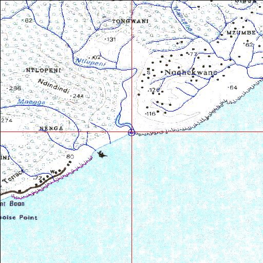
31o36'30.1"S 29o34'51.8"E
(-31.608366, 29.581048)
Map 3129DA
3890m wide x 4567m high
Cape Datum.
Surveys and Mapping.
Data from file
/iwqs3/tmp/riv/wes_akw-geo
| Ntlupeni Temporarily open/closed estuary. | ||
|---|---|---|
|
|
|
|
|
Information: Poor Condition: Excellent This estuary is a popular recreational venue for the local community |
||
|
Locality: 31o36'30.1"S 29o34'51.8"E (-31.608366, 29.581048) Map 3129DA 3890m wide x 4567m high Cape Datum. |
||
|
Surveys and Mapping. Data from file /iwqs3/tmp/riv/wes_akw-geo |
||
| <--Previous | Home^ | Next--> | |
| SA Inst. for Aquatic Biodiversity | stmaphtml.aml 2003-09-04 - 15:45:34 | |