Condition: Good
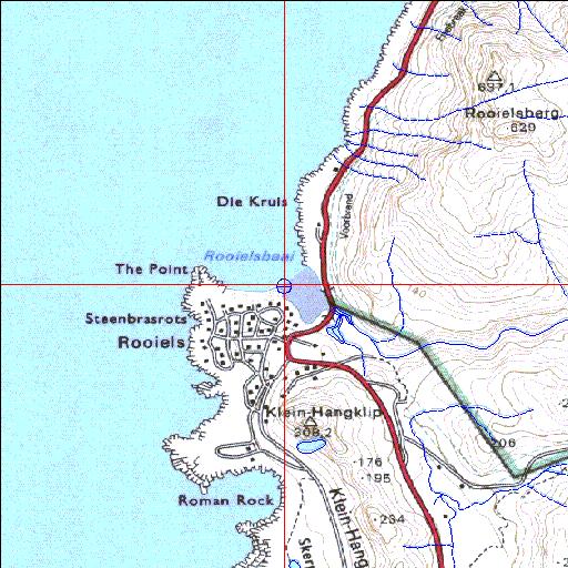
Within the proposed Rooiels/Betty's Bay nature area
34o17'50.1"S 18o49'12.4"E
(-34.297253, 18.820115)
Map 3418BD
3773m wide x 4567m high
Cape Datum.
Surveys and Mapping.
Data from file
/iwqs3/tmp/riv/wes_akw-geo
| Rooiels Temporarily open/closed estuary. | ||
|---|---|---|
|
|
|
|
|
Information: Moderate Condition: Good Within the proposed Rooiels/Betty's Bay nature area |
||
|
Locality: 34o17'50.1"S 18o49'12.4"E (-34.297253, 18.820115) Map 3418BD 3773m wide x 4567m high Cape Datum. |
||
|
Surveys and Mapping. Data from file /iwqs3/tmp/riv/wes_akw-geo |
||
| <--Previous | Home^ | Next--> | |
| SA Inst. for Aquatic Biodiversity | stmaphtml.aml 2003-09-04 - 13:37:40 | |