Condition: Fair
Water quality important for recreation
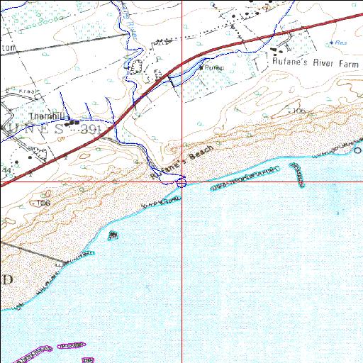
33o34'51.1"S 26o56'15.6"E
(-33.58085, 26.937676)
Map 3326DB
3805m wide x 4567m high
Cape Datum.
Surveys and Mapping.
Data from file
/iwqs3/tmp/riv/wes_akw-geo
| Rufane Temporarily open/closed estuary. | ||
|---|---|---|
|
|
|
|
|
Information: Poor Condition: Fair Water quality important for recreation |
||
|
Locality: 33o34'51.1"S 26o56'15.6"E (-33.58085, 26.937676) Map 3326DB 3805m wide x 4567m high Cape Datum. |
||
|
Surveys and Mapping. Data from file /iwqs3/tmp/riv/wes_akw-geo |
||
| <--Previous | Home^ | Next--> | |
| SA Inst. for Aquatic Biodiversity | stmaphtml.aml 2003-09-04 - 14:33:20 | |