Condition: Good
Private ownership with dune conservation potential
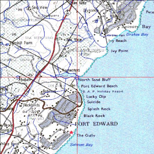
31o02'32.4"S 30o13'43.1"E
(-31.042321, 30.228643)
Map 3130AA
3913m wide x 4567m high
Cape Datum.
Surveys and Mapping.
Data from file
/iwqs3/tmp/riv/wes_akw-geo
| Sandlundlu Temporarily open/closed estuary. | ||
|---|---|---|
|
|
|
|
|
Information: Poor Condition: Good Private ownership with dune conservation potential |
||
|
Locality: 31o02'32.4"S 30o13'43.1"E (-31.042321, 30.228643) Map 3130AA 3913m wide x 4567m high Cape Datum. |
||
|
Surveys and Mapping. Data from file /iwqs3/tmp/riv/wes_akw-geo |
||
| <--Previous | Home^ | Next--> | |
| SA Inst. for Aquatic Biodiversity | stmaphtml.aml 2003-09-04 - 16:03:32 | |