Condition: Good
Has considerable conservation potential
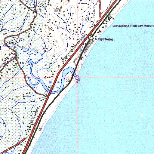
30o09'20"S 30o49'48.1"E
(-30.155557, 30.830023)
Map 3030BB
3949m wide x 4567m high
Cape Datum.
Surveys and Mapping.
Data from file
/iwqs3/tmp/riv/wes_akw-geo
| Umgababa Temporarily open/closed estuary. | ||
|---|---|---|
|
|
|
|
|
Information: Moderate Condition: Good Has considerable conservation potential |
||
|
Locality: 30o09'20"S 30o49'48.1"E (-30.155557, 30.830023) Map 3030BB 3949m wide x 4567m high Cape Datum. |
||
|
Surveys and Mapping. Data from file /iwqs3/tmp/riv/wes_akw-geo |
||
| <--Previous | Home^ | Next--> | |
| SA Inst. for Aquatic Biodiversity | stmaphtml.aml 2003-09-04 - 16:33:43 | |