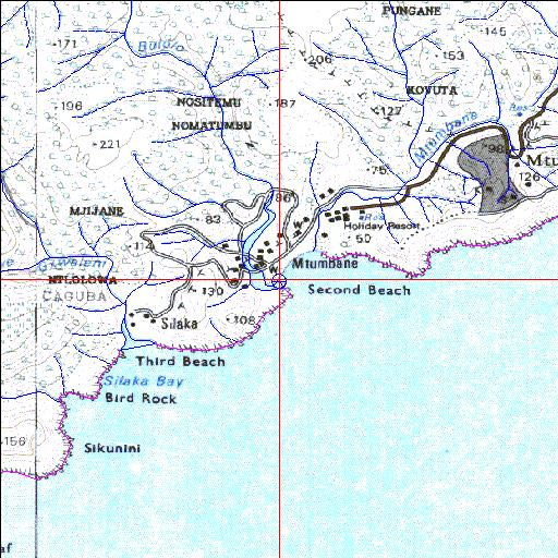
Condition: Good
Two traffic causeways traverse the system
31o39'00.9"S 29o31'04.6"E
(-31.650258, 29.517957)
Map 3129CB 3129DA
3888m wide x 4567m high
Cape Datum.
Surveys and Mapping.
Data from file
/iwqs3/tmp/riv/wes_akw-geo
| Bulolo Temporarily open/closed estuary. | ||
|---|---|---|
|
|
|
|
|
Information: Poor Condition: Good Two traffic causeways traverse the system |
||
|
Locality: 31o39'00.9"S 29o31'04.6"E (-31.650258, 29.517957) Map 3129CB 3129DA 3888m wide x 4567m high Cape Datum. |
||
|
Surveys and Mapping. Data from file /iwqs3/tmp/riv/wes_akw-geo |
||
| <--Previous | Home^ | Next--> | |
| SA Inst. for Aquatic Biodiversity | stmaphtml.aml 2003-09-04 - 15:43:20 | |