Condition: Fair
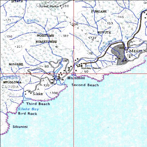
Camp site and caravan park situated on the estuary floodplain
31o38'52.3"S 29o31'14.2"E
(-31.647852, 29.52062)
Map 3129DA
3888m wide x 4567m high
Cape Datum.
Surveys and Mapping.
Data from file
/iwqs3/tmp/riv/wes_akw-geo
| Mtambane Temporarily open/closed estuary. | ||
|---|---|---|
|
|
|
|
|
Information: Poor Condition: Fair Camp site and caravan park situated on the estuary floodplain |
||
|
Locality: 31o38'52.3"S 29o31'14.2"E (-31.647852, 29.52062) Map 3129DA 3888m wide x 4567m high Cape Datum. |
||
|
Surveys and Mapping. Data from file /iwqs3/tmp/riv/wes_akw-geo |
||
| <--Previous | Home^ | Next--> | |
| SA Inst. for Aquatic Biodiversity | stmaphtml.aml 2003-09-04 - 15:44:08 | |