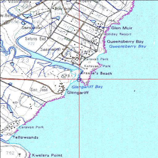
Condition: Good
Resort development in the estuary mouth region
32o53'28.8"S 28o05'38.7"E
(-32.891322, 28.094072)
Map 3228CC
3835m wide x 4567m high
Cape Datum.
Surveys and Mapping.
Data from file
/iwqs3/tmp/riv/wes_akw-geo
| Bulura Temporarily open/closed estuary. | ||
|---|---|---|
|
|
|
|
|
Information: Poor Condition: Good Resort development in the estuary mouth region |
||
|
Locality: 32o53'28.8"S 28o05'38.7"E (-32.891322, 28.094072) Map 3228CC 3835m wide x 4567m high Cape Datum. |
||
|
Surveys and Mapping. Data from file /iwqs3/tmp/riv/wes_akw-geo |
||
| <--Previous | Home^ | Next--> | |
| SA Inst. for Aquatic Biodiversity | stmaphtml.aml 2003-09-04 - 14:58:29 | |