Condition: Good
Relatively low dissolved oxygen levels in bottom waters reported
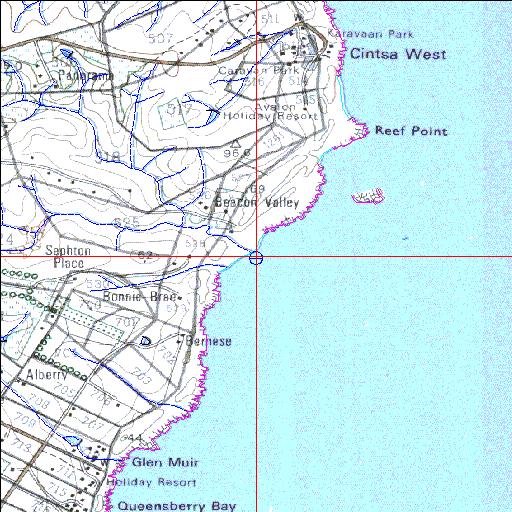
32o51'41.4"S 28o06'44.9"E
(-32.861498, 28.112464)
Map 3228CC
3836m wide x 4567m high
Cape Datum.
Surveys and Mapping.
Data from file
/iwqs3/tmp/riv/wes_akw-geo
| Cunge Temporarily open/closed estuary. | ||
|---|---|---|
|
|
|
|
|
Information: Poor Condition: Good Relatively low dissolved oxygen levels in bottom waters reported |
||
|
Locality: 32o51'41.4"S 28o06'44.9"E (-32.861498, 28.112464) Map 3228CC 3836m wide x 4567m high Cape Datum. |
||
|
Surveys and Mapping. Data from file /iwqs3/tmp/riv/wes_akw-geo |
||
| <--Previous | Home^ | Next--> | |
| SA Inst. for Aquatic Biodiversity | stmaphtml.aml 2003-09-04 - 14:59:20 | |