Condition: Poor
The system is adversely affected by weir construction and siltation
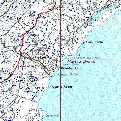
30o56'07.8"S 30o18'30.3"E
(-30.935509, 30.308407)
Map 3030CD
3917m wide x 4567m high
Cape Datum.
Surveys and Mapping.
Data from file
/iwqs3/tmp/riv/wes_akw-geo
| Kaba Temporarily open/closed estuary. | ||
|---|---|---|
|
|
|
|
|
Information: Poor Condition: Poor The system is adversely affected by weir construction and siltation |
||
|
Locality: 30o56'07.8"S 30o18'30.3"E (-30.935509, 30.308407) Map 3030CD 3917m wide x 4567m high Cape Datum. |
||
|
Surveys and Mapping. Data from file /iwqs3/tmp/riv/wes_akw-geo |
||
| <--Previous | Home^ | Next--> | |
| SA Inst. for Aquatic Biodiversity | stmaphtml.aml 2003-09-04 - 16:09:09 | |