Matjies Temporarily open/closed estuary.
Matjies Temporarily open/closed estuary. Matjies position
Information: Poor
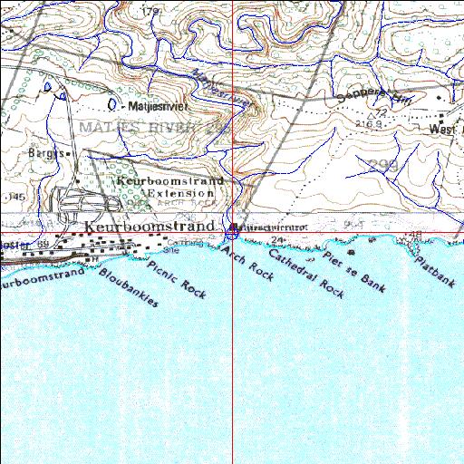
Condition: Excellent

Small system which supplies freshwater to Keurboomstrand development
Locality:
34o00'06.1"S 23o28'14.3"E
(-34.001708, 23.470635)
Map 3323CD 3423AB
3786m wide x 4567m high
Cape Datum.
South Africa DLA, DWAF 1:50 000 maps from
Surveys and Mapping.
Data from file
/iwqs3/tmp/riv/wes_akw-geo
<--Previous | Home^ Next-->
SA Inst. for Aquatic Biodiversity stmaphtml.aml 2003-09-04 - 14:04:15