Condition: Excellent
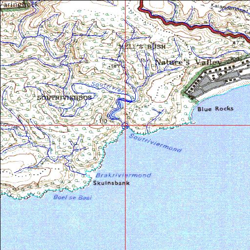
Within the De Vasselot State Forestry Reserve
33o59'21"S 23o32'12.7"E
(-33.989165, 23.536864)
Map 3323DC
3787m wide x 4567m high
Cape Datum.
Surveys and Mapping.
Data from file
/iwqs3/tmp/riv/wes_akw-geo
| Sout-East (Sout-Oos) Permanently open estuary. | ||
|---|---|---|
|
|
|
|
|
Information: Moderate Condition: Excellent Within the De Vasselot State Forestry Reserve |
||
|
Locality: 33o59'21"S 23o32'12.7"E (-33.989165, 23.536864) Map 3323DC 3787m wide x 4567m high Cape Datum. |
||
|
Surveys and Mapping. Data from file /iwqs3/tmp/riv/wes_akw-geo |
||
| <--Previous | Home^ | Next--> | |
| SA Inst. for Aquatic Biodiversity | stmaphtml.aml 2003-09-04 - 14:05:25 | |