Condition: Poor
Degraded due to siltation & pollution and mouth manipulation
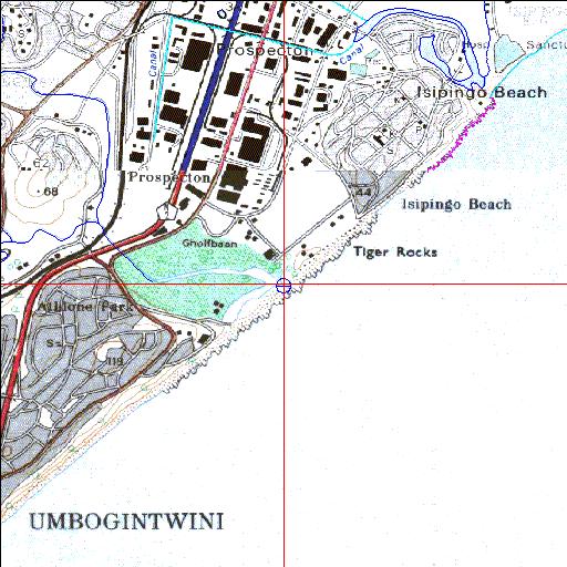
30o00'29.6"S 30o56'12.4"E
(-30.008222, 30.936791)
Map 2930DD 3030BB
3955m wide x 4567m high
Cape Datum.
Surveys and Mapping.
Data from file
/iwqs3/tmp/riv/wes_akw-geo
| Mbokodweni Temporarily open/closed estuary. | ||
|---|---|---|
|
|
|
|
|
Information: Moderate Condition: Poor Degraded due to siltation & pollution and mouth manipulation |
||
|
Locality: 30o00'29.6"S 30o56'12.4"E (-30.008222, 30.936791) Map 2930DD 3030BB 3955m wide x 4567m high Cape Datum. |
||
|
Surveys and Mapping. Data from file /iwqs3/tmp/riv/wes_akw-geo |
||
| <--Previous | Home^ | Next--> | |
| SA Inst. for Aquatic Biodiversity | stmaphtml.aml 2003-09-04 - 16:37:09 | |