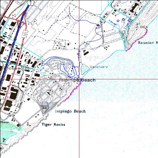
Condition: Poor
Mlazi canal diverts water previously entering the Sipingo estuary
29o59'38.7"S 30o57'05.6"E
(-29.994087, 30.951567)
Map 2930DD 3030BB
3955m wide x 4567m high
Cape Datum.
Surveys and Mapping.
Data from file
/iwqs3/tmp/riv/wes_akw-geo
| Sipingo Modified permanently open estuary. | ||
|---|---|---|
|
|
|
|
|
Information: Moderate Condition: Poor Mlazi canal diverts water previously entering the Sipingo estuary |
||
|
Locality: 29o59'38.7"S 30o57'05.6"E (-29.994087, 30.951567) Map 2930DD 3030BB 3955m wide x 4567m high Cape Datum. |
||
|
Surveys and Mapping. Data from file /iwqs3/tmp/riv/wes_akw-geo |
||
| <--Previous | Home^ | Next--> | |
| SA Inst. for Aquatic Biodiversity | stmaphtml.aml 2003-09-04 - 16:39:10 | |