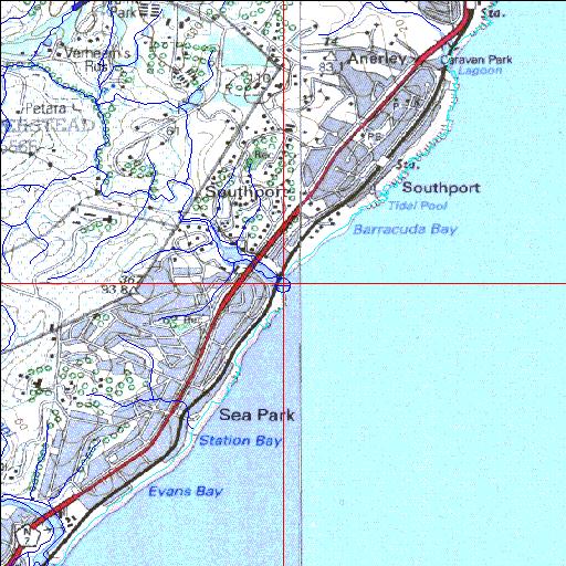
Condition: Fair
Undisturbed plant communities in upper reaches
30o41'17.6"S 30o29'55.8"E
(-30.688216, 30.498831)
Map 3030CB 3030DA
3927m wide x 4567m high
Cape Datum.
Surveys and Mapping.
Data from file
/iwqs3/tmp/riv/wes_akw-geo
| Mhlangamkulu Temporarily open/closed estuary. | ||
|---|---|---|
|
|
|
|
|
Information: Poor Condition: Fair Undisturbed plant communities in upper reaches |
||
|
Locality: 30o41'17.6"S 30o29'55.8"E (-30.688216, 30.498831) Map 3030CB 3030DA 3927m wide x 4567m high Cape Datum. |
||
|
Surveys and Mapping. Data from file /iwqs3/tmp/riv/wes_akw-geo |
||
| <--Previous | Home^ | Next--> | |
| SA Inst. for Aquatic Biodiversity | stmaphtml.aml 2003-09-04 - 16:18:49 | |