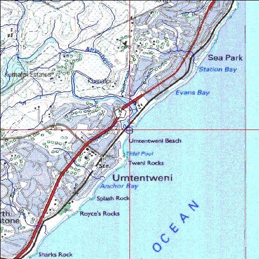
Condition: Fair
Degradation linked to sand accumulation and urban encroachment
30o42'33.1"S 30o28'54.2"E
(-30.709191, 30.481733)
Map 3030CB 3030DA
3927m wide x 4567m high
Cape Datum.
Surveys and Mapping.
Data from file
/iwqs3/tmp/riv/wes_akw-geo
| Mtentweni Temporarily open/closed estuary. | ||
|---|---|---|
|
|
|
|
|
Information: Moderate Condition: Fair Degradation linked to sand accumulation and urban encroachment |
||
|
Locality: 30o42'33.1"S 30o28'54.2"E (-30.709191, 30.481733) Map 3030CB 3030DA 3927m wide x 4567m high Cape Datum. |
||
|
Surveys and Mapping. Data from file /iwqs3/tmp/riv/wes_akw-geo |
||
| <--Previous | Home^ | Next--> | |
| SA Inst. for Aquatic Biodiversity | stmaphtml.aml 2003-09-04 - 16:17:45 | |