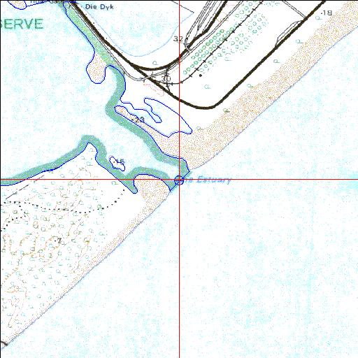
Condition: Fair
Previously part of the Richards Bay system
28o50'46.6"S 32o02'56.8"E
(-28.846267, 32.049102)
Map 2832CC
4000m wide x 4567m high
Cape Datum.
Surveys and Mapping.
Data from file
/iwqs3/tmp/riv/wes_akw-geo
| Mhlathuze Estuarine bay. | ||
|---|---|---|
|
|
|
|
|
Information: Moderate Condition: Fair Previously part of the Richards Bay system |
||
|
Locality: 28o50'46.6"S 32o02'56.8"E (-28.846267, 32.049102) Map 2832CC 4000m wide x 4567m high Cape Datum. |
||
|
Surveys and Mapping. Data from file /iwqs3/tmp/riv/wes_akw-geo |
||
| <--Previous | Home^ | Next--> | |
| SA Inst. for Aquatic Biodiversity | stmaphtml.aml 2003-09-04 - 16:53:02 | |