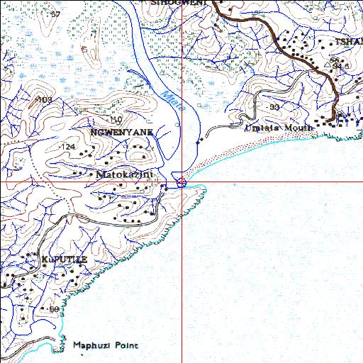
Condition: Good
Water quality and catchment management issues need to be addressed
31o57'08.4"S 29o10'57.7"E
(-31.95232, 29.182681)
Map 3129CC
3875m wide x 4567m high
Cape Datum.
Surveys and Mapping.
Data from file
/iwqs3/tmp/riv/wes_akw-geo
| Mtata Permanently open estuary. | ||
|---|---|---|
|
|
|
|
|
Information: Moderate Condition: Good Water quality and catchment management issues need to be addressed |
||
|
Locality: 31o57'08.4"S 29o10'57.7"E (-31.95232, 29.182681) Map 3129CC 3875m wide x 4567m high Cape Datum. |
||
|
Surveys and Mapping. Data from file /iwqs3/tmp/riv/wes_akw-geo |
||
| <--Previous | Home^ | Next--> | |
| SA Inst. for Aquatic Biodiversity | stmaphtml.aml 2003-09-04 - 15:31:50 | |