Mapuzi Temporarily open/closed estuary.
Mapuzi Temporarily open/closed estuary. Mapuzi position
Information: Poor
Condition: Excellent

This system is used by commercial fishermen as a ski boat launch site
Locality:
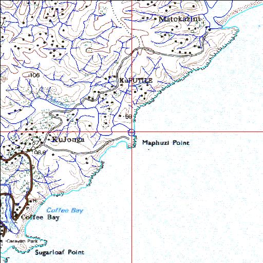
31o58'08.8"S 29o10'07.4"E
(-31.969121, 29.168728)
Map 3129CC
3874m wide x 4567m high
Cape Datum.
South Africa DLA, DWAF 1:50 000 maps from
Surveys and Mapping.
Data from file
/iwqs3/tmp/riv/wes_akw-geo
<--Previous | Home^ Next-->
SA Inst. for Aquatic Biodiversity stmaphtml.aml 2003-09-04 - 15:30:35