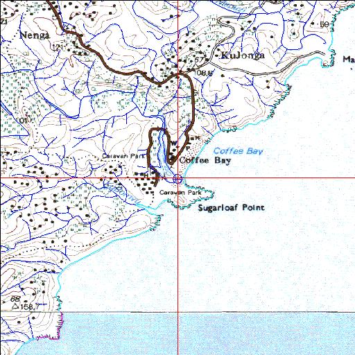
Nenga Temporarily open/closed estuary.
Nenga Temporarily open/closed estuary. Nenga position
Information: Poor
Condition: Good

Estuary floodplain impacted by road and other infrastructural developments
Locality:
31o59'04.2"S 29o09'04.6"E
(-31.984507, 29.151275)
Map 3129CC 3229AA
3874m wide x 4567m high
Cape Datum.
South Africa DLA, DWAF 1:50 000 maps from
Surveys and Mapping.
Data from file
/iwqs3/tmp/riv/wes_akw-geo
<--Previous | Home^ Next-->
SA Inst. for Aquatic Biodiversity stmaphtml.aml 2003-09-04 - 15:29:10