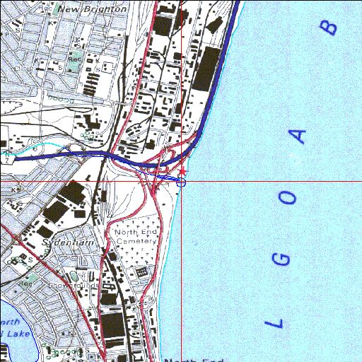
Condition: Poor
Functions as an industrial canal
33o55'02.1"S 25o36'50.5"E
(-33.917253, 25.61402)
Map 3325DC
3790m wide x 4567m high
Cape Datum.
Surveys and Mapping.
Data from file
/iwqs3/tmp/riv/wes_akw-geo
| Papkuils Canalized estuary. | ||
|---|---|---|
|
|
|
|
|
Information: Poor Condition: Poor Functions as an industrial canal |
||
|
Locality: 33o55'02.1"S 25o36'50.5"E (-33.917253, 25.61402) Map 3325DC 3790m wide x 4567m high Cape Datum. |
||
|
Surveys and Mapping. Data from file /iwqs3/tmp/riv/wes_akw-geo |
||
| <--Previous | Home^ | Next--> | |
| SA Inst. for Aquatic Biodiversity | stmaphtml.aml 2003-09-04 - 14:25:53 | |