Condition: Poor
Could be considered for rehabilitation
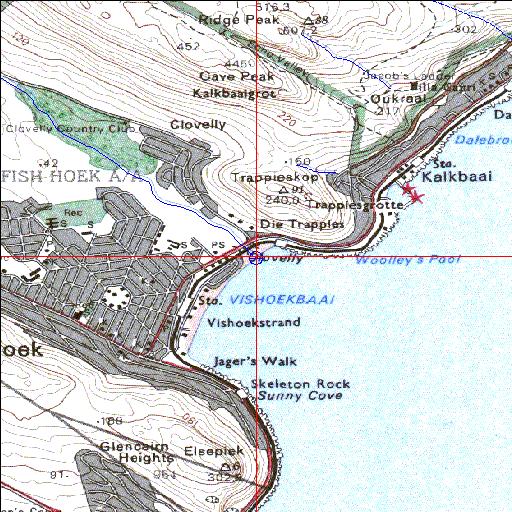
34o07'58.4"S 18o26'20.4"E
(-34.132884, 18.439013)
Map 3418AB
3780m wide x 4567m high
Cape Datum.
Surveys and Mapping.
Data from file
/iwqs3/tmp/riv/wes_akw-geo
| Silvermine (Silwermyn) Temporarily open/closed estuary. | ||
|---|---|---|
|
|
|
|
|
Information: Moderate Condition: Poor Could be considered for rehabilitation |
||
|
Locality: 34o07'58.4"S 18o26'20.4"E (-34.132884, 18.439013) Map 3418AB 3780m wide x 4567m high Cape Datum. |
||
|
Surveys and Mapping. Data from file /iwqs3/tmp/riv/wes_akw-geo |
||
| <--Previous | Home^ | Next--> | |
| SA Inst. for Aquatic Biodiversity | stmaphtml.aml 2003-09-04 - 13:33:14 | |